Monday, October 14, 2024

Return to Lijiasun, 30 years later


If you read my account of my first trip to Muli, now more than 30 years ago, you will know that my first port of call once I 'walked off the map' was a small village in the hills north east of Yongning which Rock called Lijiasun. It was a couple of hours hiking from the hot springs near Yongning and back then it was a very primitive place of log cabins inhabited by rough-looking Mosuo, Naxi and Mongol people. No electricity or roads, and very few amenities such as running water. It reminded me me of the medieval village in Monty Python's Holy Grail - subsistence farmers literally living in mud.


I was to visit Lijiasun again in about 2004, when it was little changed, ie still very primitive.

So it was interesting to revisit Lijiasun (now known as Lijiaju 利家咀) a couple of weeks ago and find it transformed into a kind of Eco-Ethnic Holiday Village, now billed as "Lijiazu - the last Daba Matriarchal Heritage Village" tarted up and consisting of guesthouses and holiday homes, performance spaces, floral displays and with mobile phone towers powered by banks of solar panels.


What happened?

Well according to Chinese media, Lijiasun was recognised as a place of particular deprivation and isolation  about a decade ago, and became the target of modernisation and poverty alleviation efforts to develop Ecological businesses an install 4G broadband services etc. It has certainly made a big impact and transformed the village.

We drive there in about an hour from Yongning along a decent road, and parked up in the village 'square' next to a stupa, with a noticeboard now inundated with announcements and signposts. There was another tourist coach in the car park and a group were roaming around, photographing everything.

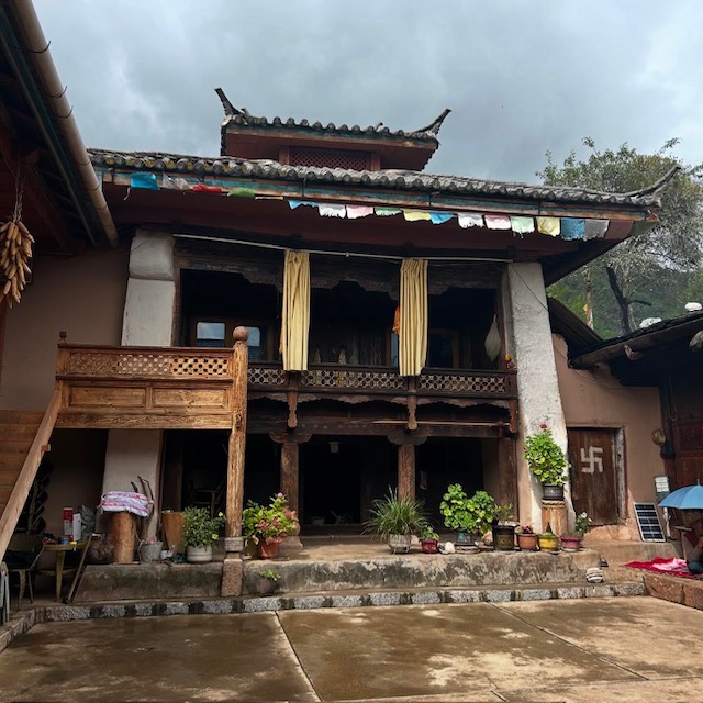
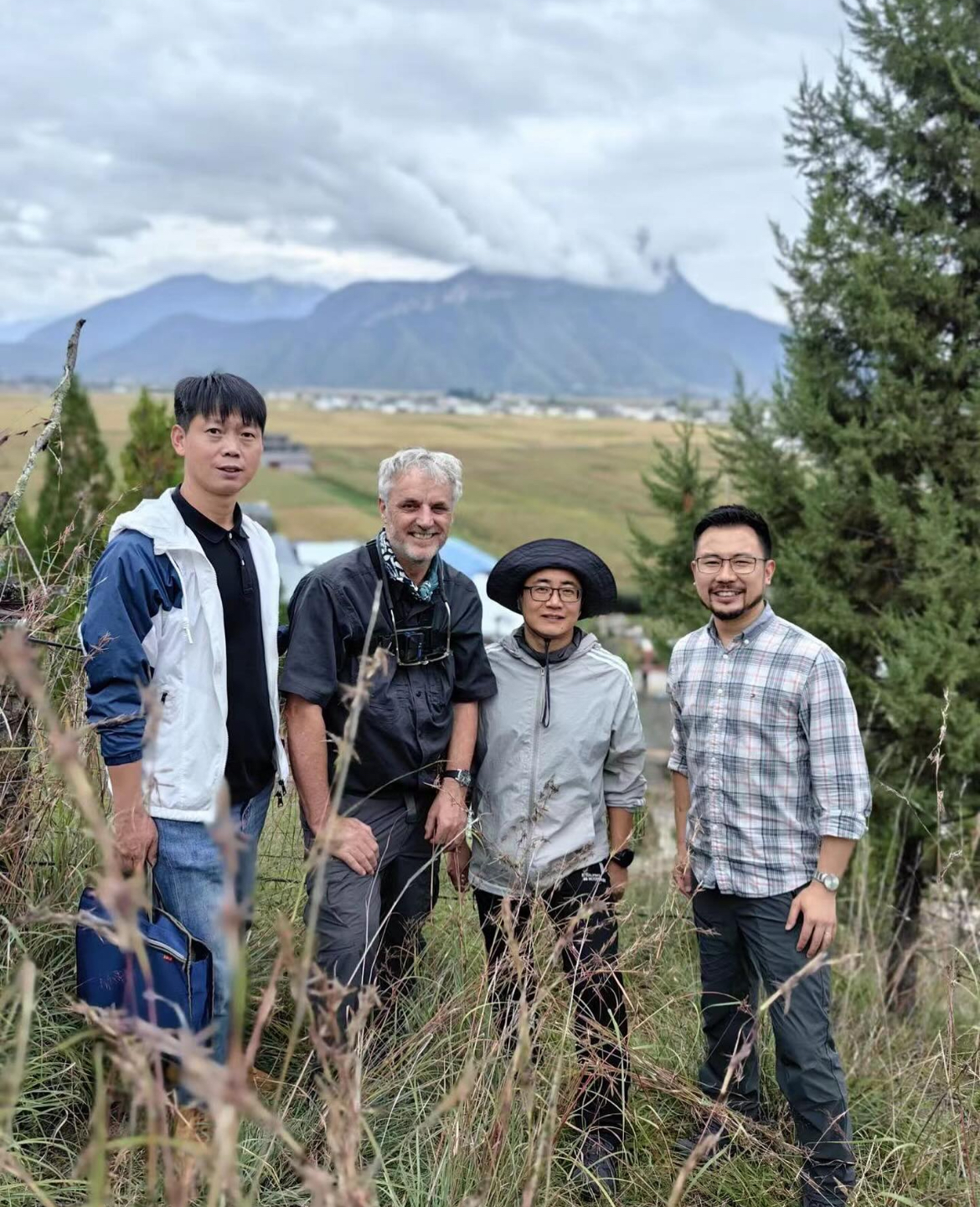
We met one of the village leaders, a livewire guy who calls himself 'Black Wolf' on his WeChat account, and who took us to find one of the older villagers who might recognise some of the people I photographed 30 years ago.  Uncle Du Ji  - a man in his fifties - lived in an ornate old wooden 'siheyuan' - a quadrangle courtyard house with an old prayer room at the centre. 


He invited us in to drink butter tea and eat walnuts, as I explained how I'd visited here before three decades ago. As I took out my phone to show him my photos, he waved it away and said "No need - I have them already". And to my astonishment he scrolled though his own phone's photo album to show me my own photos that he said he had downloaded many years ago from this blog site! At the time they were some of the few existing photos of people of that generation, he said.


"So you are the foreigner who took these pictures," he said, and proceeded to give me a rundown on who the people in the photos were - the young men staring sullenly into my camera lens, now an older businessman. The wretchedly poor people gathered round an open fire on the hillside - some now have died, bit others are still in the village, making a living in farming.


I spent a happy hour taking photographs and being shown around his magnificent dwelling house - now a holiday homestay - and the temple within. He had portraits on the wall of Genghis Khan (the Mongol ethnicity link comes from the leftovers of Khan's army venture into Yunnan a millenia ago) and groups of local people in traditional dress. I was also the subject of quite a few photos when the visiting tourists heard about my story - and wanted to get a picture with the 'old foreigner'.


Du Ji then guided us on our main mission for the day - to identify the location where a photo of Lijiasun was taken many decades ago. We thought it was a Joseph Rock photo, but a sharp eyed villager pointed out that a child in the photo was wearing more modern clothes, possibly from the 1980s onwards.

Our photo location quest took us on a hike up the hill behind the village, where we struggled to match the exact location because there were now new buildings and a lot more overgrowth of bushes and trees where it had once been a barren hillside.

It would have been nice to stay longer in Lijiasun, but we had to move on the get to Muli the same day - and that meant a long drive over the mountain pass.

Monday, October 07, 2024

Mission accomplished - solving the 100-year old mystery of Joseph Rock's Mt Mitzuga (木仔耶, 木里) photo


 Just back from an excellent trip to Muli (木里), in the company of Professors Zhu Dan and Wang Liang from Chengdu and Nanchong, respectively.

The highlight of the trip was finding the location of the photo taken by Joseph Rock of an alpine tarn just below the crags of Mt Mitzuga (Chinese: 木仔耶, Muziye). In the original photo there are two figures on horseback in the foreground. We managed to find this spot (and recreate the photo, the place is unchanged) after many hours of terrible driving on a rough 4WD track from Wachang, including two punctured tyres.

Other highlights of the trip were returning to places I had visited 30 years ago on my trek from Lugu Lake to Muli - including Yongning's Zhamei Si monastery, the village of Lijiasun, the Renjom Gompa temple, Wujiao and of course Wachang town just near the monastery. Amazingly, at these places I was able to meet people who had been there 20-30 years ago and remembered me 'the foreigner' from those times. I will write about this later.

For this post, though, I will describe how we got to the summit plateau of Mt Mitzuga, which is at a height of between 4300 and 4700 metres.

Driver Jiang Rong, me, Prof Wang, Prof Zhu Dan,

(Pic: Driver Jiang Rong, me, Prof Wang, Prof Zhu Dan)

The credit goes to Professor Zhu Dan of the Chinese Academy of Sciences Chengdu Botanical Research Institute. It was he who kindly invited me along on the trip that he organised, with three 4WD jeeps, a film crew and two local guides. I had always wondered about the location of that photograph, and was curious as to how Rock got to the summit crags of Mt Mitzuga from Muli. 
 
If you have read this blog you will know about our 1996 trip to Muli with some kiwi trekkers, in which we tried to cross from Muli to the Shuiluo river valley via Mt Mitzuga. That trip failed because we became snowbound over night and lost our way, bashing through knee deep snow and thick pine forests, unsure of where we were and making very slow progress over fallen trees. 


We never saw the summit crags of Mitzuga because the weather brought low cloud and fog. We eventually 'crashed out' by following a logging road to Baiyangping and hitching a ride on a truck back to Muli.

(The green line shows the approximate route we took from Wachang to Mitzuga. The red line is the sealed highway that now runs to Muli monastery from Yongning (Lugu Lake) and Wujiao).

This time, Zhu Dan was better prepared, but we still hit a few snags. I'd seen on Google Earth that there appear to be a few tracks criss-crossing the summit plateau of Mitzuga, but it's hard to follow them and many seem to peter out into nowhere. But with two local guides on board, we set off from Wachang on an overcast September day to try access the summit tracks. In hindsight we should have tackled the approach from the western side, via the new highway that runs via Guzheng, Maoniuping and Baiyangping to the Shuiluo valley. 


Instead, we took the advice of our guides, who thought our priority was to see the best of Mt Mitzuga scenery rather than one specific part of the summit plateau. Their route took us back over the road towards Wujiao (now sealed), over the pass and to a very well hidden turnoff at a corner of a zig-zag above Wujiao,  near a collection of huts. The 'road' was not even a dirt track, but a faint trail riven by ruts, boggy puddles and eroded sides. Even our Toyota Landcruiser (Prado) had difficulty navigating the bumps and tight corners. 
 
We probably started at around 10am on the track, which initially consisted of a switch back mud track up in the fog to a small alpine lake. We stopped their for a route planning discussion, at which Zhu Dan realised the guides had brought us the 'long way' and insisted we head back to wards the priority area rather than stopping for sightseeing.


Without giving a blow-by-blow account of the road trip, suffice to says it was extremely challenging and also supremely beautiful. Credit must go to our skilful driver, Jiang Rong, from Chengdu, who was able to get the jeep through some appalling track conditions while making it look easy - and keeping us entertained with his witty conversation in the process.


In some sections it was a reasonable gravel track, in other places it deteriorated into just a couple of faint lines in the grass or mud. We crossed over open moorland and scrub, past huge limestone crags, and sometimes plunged back into thick spruce or larch forest.

 Occasionally we saw log cabins or small farm settlements, but nobody appeared to be living in them.


A couple of hours in, at a bleak pass strewn with prayer flags we had to stop to change tyres on two of the jeeps, which had suffered punctures. Is this a world record for a tyre change at an altitude of 4500m? 

As we milled around I quickly regretted not bringing my fleece - the wind was bitingly cold, but thankfully Zhu Dan had a spare down jacket that he lent me. After about 40 minutes delay we continued, following the track that seemed to go down one side of a canyon and then cross over and come up the other side. 

On a few occasions the road forked and we were reliant on the guides to tell us which direction to pick. They also helped when we found the road blocked by log gates, which they were able to open [dissemble] and close again quickly.


Finally, in the late afternoon around 4pm we drove uphill to a line of crags that looked similar to the ones in Rock's photo. The guides told us this was the place, and we excitedly piled out of the jeeps to take a closer look. We had to hike uphill for about ten or fifteen minutes to reach a suitable viewing spot, and then it was clear that this WAS the spot - these were the crags that appeared in Rock's photo. 


But the foreground looked different - there was no small tarn or lake evident. At first we assumed that it had dried up, perhaps because it was seasonal and required some rainfall to fill it. But Zhu Dan and his team kept on moving up the hill for a few more minutes and finally they came across the small round patch of water exactly as it looked in Rock's photo. On close scrutiny we could see that the rocks around the water were exactly the same as the ones in Rock's photo - and even a small rock protruding from the water in the middle of the pond was still just as shown in Rock's photo.

To say I was thrilled was an understatement. It felt uncanny to be in exactly the same spot as where Rock had taken to photo 100 years ago, especially as the scene was completely unchanged. I must admit there is some uncertainty over the date of the original photo. Rock first visited Muli in 1924, and may have taken the photo in that year. But he also revisited Muli in 1928 on his way to Konkaling (Yading), during which trip he crossed the Mitzuga twice, so the photo may only be 96 years old!


We milled around the area, of course taking many photos and videos, and also conducting some interviews for the TV crew that Zhu Dan had invited along to record the journey. I did my interview in a hailstorm!

I could have spent a whole day up there, exploring, but agonisingly after such as long trip, it was late in the days and we had to depart after about half an hour so that we could get back to Muli during daylight. I wouldn't want to try navigate those mountain tracks in the dark. I really didn't want to leave, but time was against us - it really felt like a magical place. The guides later told us that this was a sacred spot for the Muli people - they believed that if the lake and crags were disturbed by human sounds, it would trigger hail and snow storms - just as we had experienced!


So reluctantly we set off, to complete our traverse of the summit plateau. The ordeal wasn't over yet - it was no easy downhill retreat. There were still many miles of poor track, uphill and downhill sections and more gates to open and close. We still didn't encounter a single soul, until at dusk we finally reached the 'main highway', the sealed road that now crosses the watershed from Muli to the Shuiluo valley.

We made it just in time: it was dark by the time we started the long zig-zag switchback road back down in to the Muli valley. Phones started pinging and buzzing - we had a signal again after being off the grid all day.

Suffice to say we were in a celebratory mood by the time we got back to Wachang - justification for a big meal with plenty of baijiu and toasts.